Categories
Going Green Live-work-play Urban Planning

urban parks bring us together

urban parks bring us together

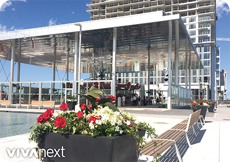
Having at least one feature park is a hallmark of a great city. Central Park in New York, Stanley Park in Vancouver and High Park in Toronto – they’re all natural gathering places. We go there on a hot summer day to find some shade or a splash pad, and on a snow day we go there to skate or make a snowman. Parks make our towns and cities more appealing places to live and work, so it’s important to have them right in the centre of things, where we can get to them easily by taking transit, walking or cycling.

Green parks are beautiful, and a refreshing change from the indoors, but there is also something to be said for the more activity-oriented parks and parkettes. In Markham, Toogood Pond and Milliken Mills are full of picturesque trees and ponds, but the Pride of Canada Carousel in the heart of Downtown Markham also offers a fun diversion from everyday life. If you don’t live right around the corner from these, you can get there on YRT or Viva.

In Newmarket, Fairy Lake Park and the Mabel Davis Conservation Area provide green places to gather for sports and culture, connected by the Tom Taylor and Nokiidaa Trails and meeting in the middle at the Riverwalk Commons, where people gather for concerts and events throughout the year. Mabel Davis and the Tom Taylor Trail can be reached via the new Viva yellow route on Davis Drive, and on the south end of town, YRT will get you there.

In Richmond Hill, Lake Wilcox Park has cultural and culinary events most summer weekends, and is a stone’s throw from the new Oak Ridges Community Centre and Pool. A short walk west from the Viva blue route on Yonge Street is Mill Pond Park – the heart of Richmond Hill’s downtown and host to concerts and neighbourhood festivals all year.

Parks can be activity-focused too, such as Vaughan Grove Sports Park in Woodbridge, offering several soccer and baseball fields just south of Viva and YRT routes on Highway 7. On the northeast corner of Highway 7 and Jane Street, Vaughan Metropolitan Centre will be adding one more important development to this already bustling construction area: an urban park. Edgeley Pond and Park will be in the middle of commercial and residential developments – a place welcoming to all who will live and work there. With a rapidway on Highway 7, the northernmost station of the Spadina subway line and a bus terminal at Highway 7 west of Jane, this park will be connected in all directions.

As we start to see a hint of the spring weather to come, let’s remember how important it is to have great parks, connected by great transit.

 

Categories
economic & financial Urban Planning

change that works

change that works

Cities around the world are searching for safe, sustainable ways to provide mobility to residents across towns and cities. VivaNext, a leader in rapid transit, has risen to the challenge. We pride ourselves on designing a great transportation system that has social significance and measurable benefits.

VivaNext is proud to support the triple bottom line. This business principle holds that business activities should result in financial, social and environmental benefits. The benefits of rapidways are easy to see. For example, the dedicated bus lanes not only allow for fast, convenient service across the region, but they also help facilitate a safer road for drivers, pedestrians and cyclists alike. In addition, emergency service vehicles are able to access the rapidways and cross the median at designated intervals, which improves their response time and bypasses congestion.

What may not be immediately visible, however, are some of the positive economic and environmental impacts rapidways create for communities.

economic development & impact

  • Well thought-out and well-designed transit attracts sustainable, mixed-use development, including new businesses, jobs and a variety of housing options
  • Easy access to transit creates a more desirable mixed-use neighbourhood, and allows for money to be reinvested into the community (through businesses or reinvesting in local infrastructure)
  • Based on other rapid transit projects across North America, property values increase for land within walking distance to transit stations
  • As the Region’s urban transit corridors evolve and attract new retail and restaurants, other new employers wanting to be near transit will follow, continuing to support future economic and social growth

environmental responsibility

  • Every busload replaces approximately 70 vehicles on the road, which means a reduced carbon footprint
  • Rapid transit systems create a safer, more accessible and walkable city

With so many positive benefits of rapid transit, it’s no wonder York Region is a leader in transforming our communities by providing safe, convenient rapid transit. Join us and be moved.

Categories
Accessibility Safety Technical Urban Planning

making corners work for everyone

making corners work for everyone

In civil engineering-speak, curb radius refers to the curve of the curb as it goes around a corner; sometimes it’s a wide gentle bend, and sometimes it’s a tight right angle. So here’s a question: when’s the last time you waited at an intersection for the light to change and actually even noticed the curb radius?  If you’re like pretty much everyone else, probably never.

And yet, believe it or not, the curb radius is one of the most important components of streetscaping, and has a profound influence on how drivers and pedestrians use a street.

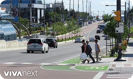
As you already know, streetscaping refers to all the elements making up the public spaces along our streets. Because a key vivaNext goal is to make everyone feel welcome on our streets, whether they’re walking, biking, waiting to hop on Viva, or driving, we pay a lot of attention to streetscaping considerations. This includes the curb radii for every single intersection and entrance along our rapidways.

The curb radius describes the shape of a corner, such as when two perpendicular streets come together at an intersection, for example. The curb radius is expressed as a number, taken from the radius of the curve connecting the curbs of the two streets. On a wide suburban corner, the curb radius might be as high as 35, whereas on an urban street corner, it might only be 2.

Most urban settings, including along our vivaNext rapidways, aim for a smaller curb radius wherever possible.  That’s because the smaller the curb radius, the shorter the distance a pedestrian has to walk to get to the other side of the road. A smaller curb radius has other impacts too. It results in more space at the corner, including more space for accessible ramps. It makes it easier to line up crosswalks with connecting sidewalks.  It improves the sightlines for pedestrians and makes pedestrians more visible to drivers. And it slows down turning movements for vehicles going around corners, which is safer for pedestrians.

Of course, curb radius design also considers the needs of drivers, including traffic volume, vehicle size, and their desired speed going around corners. It also has to take into account bike lanes, on-street parking, bus stops, emergency vehicles, and other design requirements.  Whether or not the road is part of a truck route may affect the curb radius, because trucks need a larger turning radius to be able to navigate turns while staying within their lane.

Our final curb radius design isn’t up to us alone, of course.  Our designs reflect standards and requirements set by York Region and the municipalities as part of their broader planning for their regional and local road networks. Those requirements in turn reflect the design standards from a variety of authorities including guidelines from the Transportation Association of Canada and the Ontario Ministry of Transportation.

There’s a lot involved in the design of a simple concrete curb than you probably would have guessed. But the final result is for a more welcoming, safe and accessible streetscape for all users.


Categories
Facilities and terminals Stations Transit Urban Planning

connecting people to people

connecting people to people

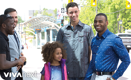
Have you ever wondered why the central markets, main streets and train stations of old cities thrive for so many years? Whether it’s the Temple Street Market in Hong Kong, the piazzas of Italy, or Toronto’s Union Station, it’s important to have a place to gather and connect. Somewhere to meet a friend or someone new, wait for the next bus or train, or just people-watch.

We all want to be around people, at least some of the time – Aristotle once said “man is by nature a social animal.” So in York Region, we’re hard at work building attractive places to spend our “connecting” time. A warm area at the station while you wait for Viva [it won’t be long!]… a place to buy coffee at the SmartCentres Place Bus Terminal in Vaughan, tree-lined sidewalks in Newmarket for walking along Davis Drive, or a trellis-covered plaza with benches to meet a friend at Cornell Terminal in Markham.

In this world of internet and mobile devices it’s easy to find ourselves isolated from the general population, so we’re using smart design to make sure everything we build connects people – not just vehicles.


Categories
Accessibility Construction Stations Subways Technical

matching the heights

matching the heights

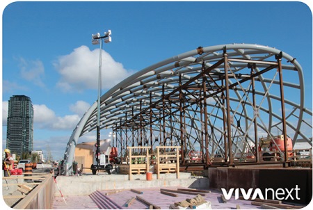
With the extraordinary maneuvering required to install the roof sections of the VMC BRT station in its location in the centre of Highway 7, you might think the most challenging part of this project has been its incredible glass and steel canopy.

It’s true that installing the canopy of the station required a lot of planning and meticulous engineering. But actually, the coordination of the underground subway station with the BRT station above has been – and still is – a much more complex logistical challenge.

the mechanics of it all

Building the actual physical connections between the two structures was involved but not unduly complicated, similar to any building that has a framed structure on top of a concrete slab. Because the top of the station is wider than the lower part and overhangs at the edges, we couldn’t use rebar dowels, which are the most common construction method. Instead, we used mechanical couplings that enabled us to essentially bolt the top to the bottom.

working together

What makes the project more challenging is that the subway station is being built by the TTC, while the above ground BRT station is being built by vivaNext. With two different owners, and two different contractors, the project demands an intensive degree of coordination and planning.

Joint planning work began long ago, starting with establishing the specific requirements for how the project needed to be built, both below and above ground, and inside and outside the subway station. With the TTC building the subway station up to the surface, and vivaNext building the BRT station from the ground up, the heights of floors and ceilings had to line up perfectly.

top to bottom, inside and out

The vertical elements between the lower and upper floors – including the stairs, escalators and elevators – had to be installed early, with no margin for error. Escalators are very rigid, designed to fit perfectly between floors. And because the rapidway runs right through the station, the top of the escalator, stairs and elevator also had to align precisely with the existing level of Highway 7 outside.

At the same time as the TTC was building the lower levels of the subway station, we were outside building the civil works – the roadway, curbs and gutters – that surround the BRT station. Again, because the rapidway runs through the station, the heights of the underground parts of these elements had to fit with the height of the subway box below.

The BRT station is well on its way and is already a head-turner. In the not-too-distant future, all of this engineering and coordination will make it possible for you to step off the escalator at VMC subway station and easily make your way to the BRT station on Highway 7 and beyond.

See an artist’s rendering of the VMC BRT station once complete.